Explore Our Services
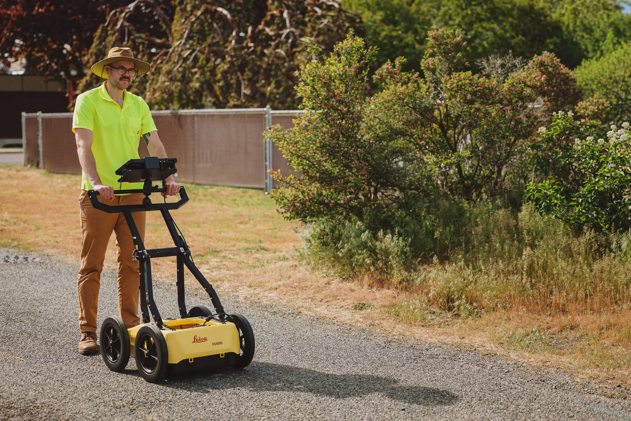
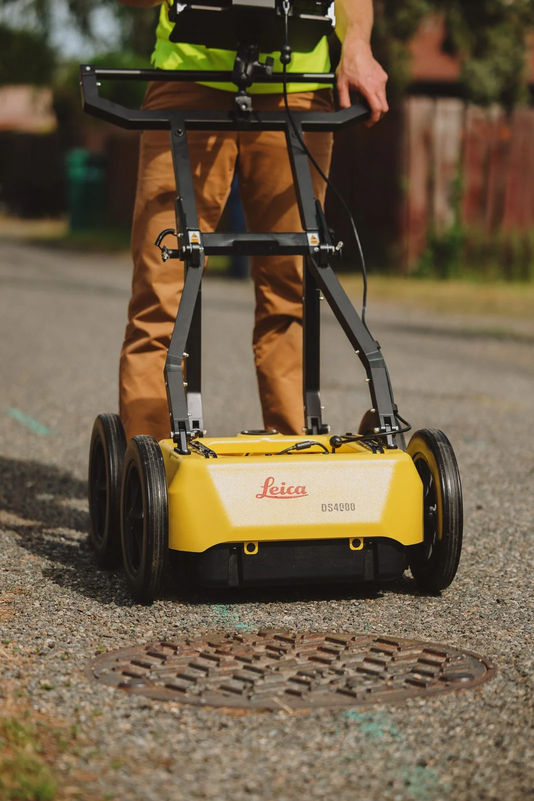
Underground Site Intelligence
Explore the range of site intelligence and subsurface utility services Dynamic offers. From private utility locates to preconstruction site surveys with integrated drone imagery, Dynamic GeoServices has what it takes to ensure your project can break ground safely and with confidence.
For more complex, extensive, or ongoing service and support, Dynamic offers tailored geospatial data collection and management services as well as on call and term based locating contracts for peace of mind.
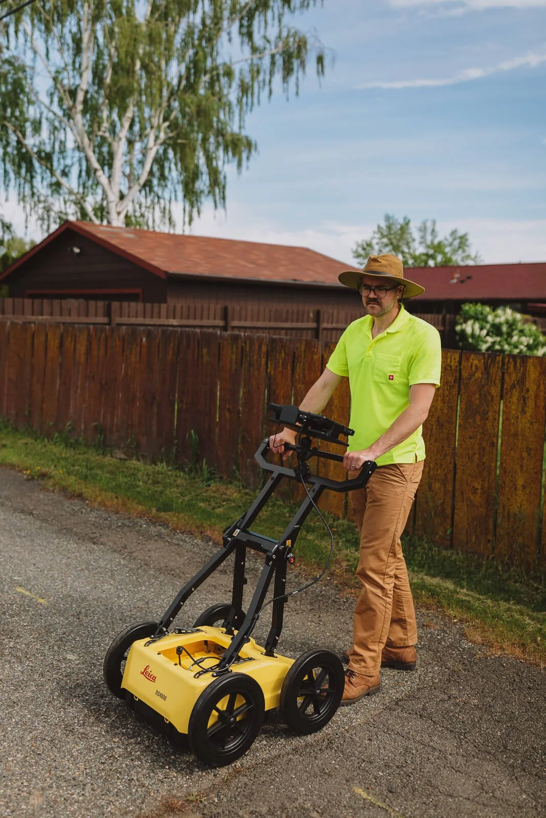
Ground Penetrating Radar
We offer a range of utility locating services with GPR to meet the needs of every client. Have a specific need or scope of work in mind? We'd be happy to work with you to create a custom quote.
-
Basic site intelligence and utility locating services to get your job site ready to break ground.
Typically includes full site GPR scanning and marking, located asset points exported as a simple shapefile.
-
Full basic service with added asset collection using high accuracy GNSS devices for lines and points, attributes table including elevation and other known details for across the entire site. GPR scan and asset dataset is compiled and delivered in GIS and CAD compatible formats.
A full report is delivered for the site survey including detailed write up of GPR scans, assets collected, and site conditions.
-
More complex projects require more detailed deliverables. Dynamic’s Advanced Services package includes all the Basic and Intermediate services such as site GPR scanning and utility marking, asset collection using high accuracy GNSS devices, post processed datasets for GIS and CAD, and detailed reports.
Also included are modeled or integrated data management services as needed to ensure collected site information is synced with your existing systems and plans. Advanced QA/QC to ensure data operability and functionality in your desired system of record, as well as enhanced reporting with optional recommendations and integration with other projects either in progress or forthcoming.
Dynamic’s Advanced Services is designed for customers working on larger municipal public works or capital projects, development projects, and multiphase projects where developing deeper, system level understanding of the below-ground environment is crucial to meeting tight project timelines and budgets. Underground site intelligence that can be trusted in the field and in the planning room enables decision makers and move forward with certainty.
Private Utility Locating
Private Utility Locating - Zone 1
Need to replace your sewer line? Wanting to extend your house and dig a new foundation? Knowing what’s under the ground and where to dig before you begin your project is the safest way to start. Let Dynamic GeoServices scan and mark your property so that you can break ground with confidence!
$500 + tax
Up to two hours of. utility locating services within 25 miles of Ellensburg, WA.Private Utility Locating - Zone 2
Private utility locating in zone 2 includes areas within 150 miles of Ellensburg.
$600 + tax
Up to two hours of. utility locating services within 150 miles of Ellensburg, WA.Contact us for a custom quote if you reside farther than 150 miles from Ellensburg!